


Headlines
- SEVERE THREAT IS OVER
- MUCH COLDER THURSDAY
- RAIN/SNOW SHOWERS LIKELY
From spring storms to a winter like feel and potentially look for our Thursday. Temperatures will only be in the low to mid 40s for afternoon highs. The wind will make it feel even colder than that so bundle up.
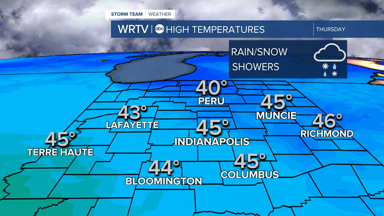
Don't be surprised if you see some rain and snow showers moving through the area as well at times. There will be no snow accumulation but here we are on the first day of spring talking about it.

The chill is brief though. We are back above normal with sunshine on Friday and then in the low 50s for the weekend.

Could be some light rain overnight Friday into Saturday with better rain chance arrive during the day on Sunday.
Indianapolis Weather Forecast:
Overnight: Turning colder. Low: 27°
Tomorrow: Rain/snow showers. Chilly. High: 45°
Friday: Partly cloudy. High: 57°
Indianapolis 7-Day Weather Forecast

