

Headlines
- PM RAIN COVERAGE DIMINISHING
- HUMID ALL WEEK
- NEAR DAILY CHANCE FOR RAIN
Although drier than this morning, afternoon showers and isolated thunderstorms are still possible.
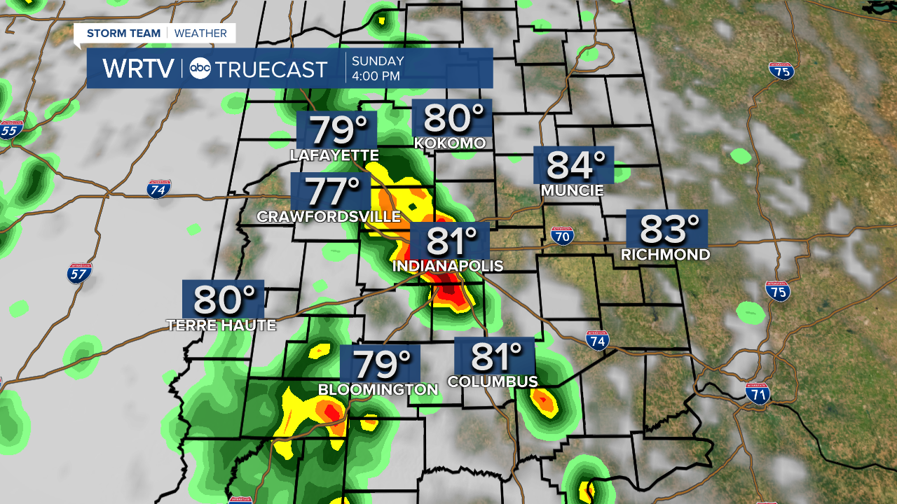
Temperatures should be able to make it in to the 80°s before rain arrives. Areas that receive rain later will make it in to the middle 80°s. Areas where the rain hits first, temperatures will top out around 80°.

Humidity will be a big weather impact this coming week. Dew point temperatures - the measure of the moisture in the air - will be in the lower and middle 70°s. It isn't out of the question for the dew points to reach the upper 70°s in some locales. This will make it feel very tropical, especially Tuesday through Friday.
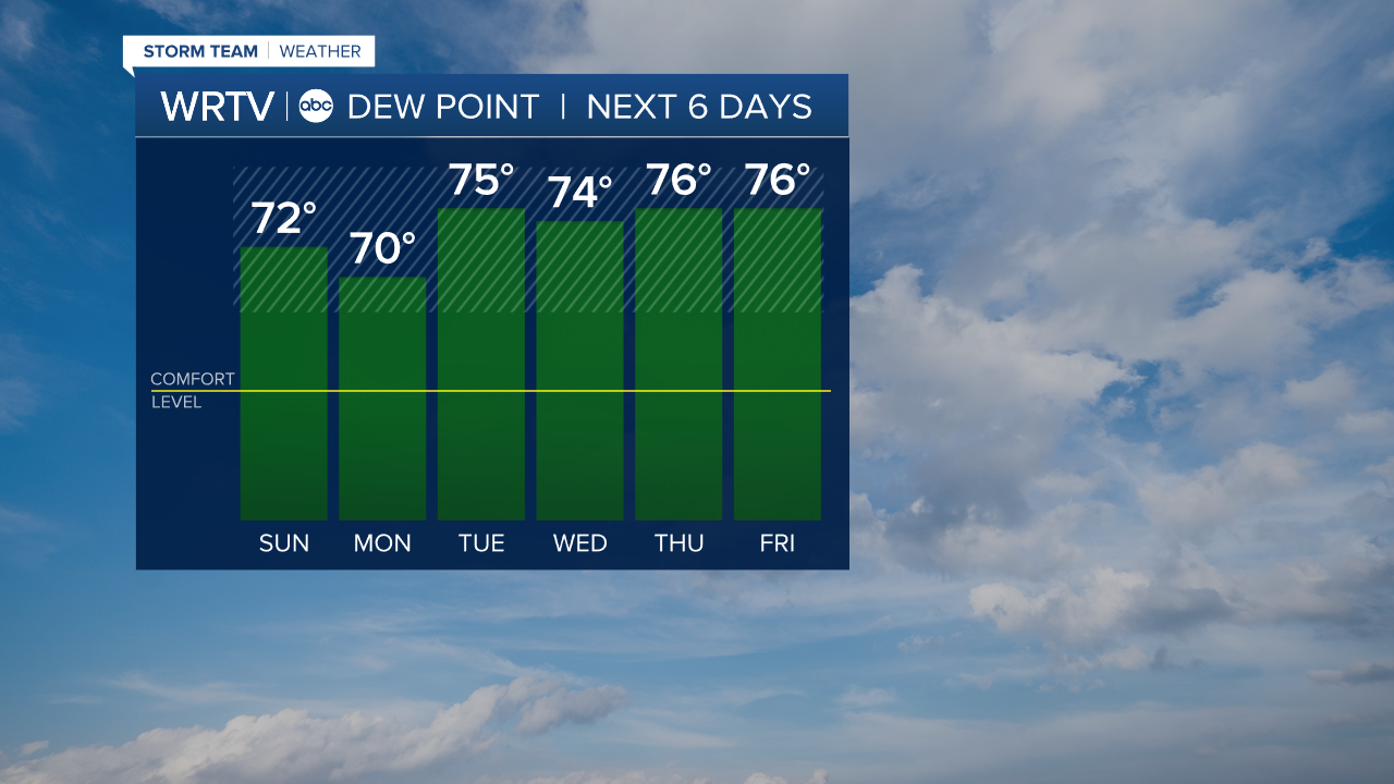
While temperatures won't be terribly warm, because of the humidity it will feel like it is 100°+ several days this week. I'm targeting Wednesday, Thursday, and Friday as being the best chance for 100°+ heat indices.
Indianapolis Weather Forecast:
This Afternoon: Isolated showers/t'storms. Humid. High: 84°
Monday: Scattered showers/t'storms. Humid. High: 84°
Tuesday: AM scattered showers. Turning partly cloudy. Very humid. High: 88°
Wednesday: Isolated t'storm. Very humid. High: 92° | Peak heat index: 104°
Indianapolis 7-Day Weather Forecast

