


Headlines
- TRACKING ANOTHER STORM COMPLEX
- WARMEST & MOST HUMID DAY OF WEEK
- MIDWEEK COLD FRONT DROP TEMPERATURES
It is very much a "rinse and repeat" forecast for central Indiana. It is going to be warm and very humid during the afternoon and there will be a chance for a complex of thunderstorms to pass through on a daily basis through Tuesday.

The "hot dome" remains in place over the western-southern-southeastern United States. This is where all the big heat is located across the country.
The "hot dome" is high pressure located in the upper levels of the atmosphere. It causes the air to sink underneath which then compresses once reaching the ground. When you compress a gas - like air - it heats up quickly. This is why it is important to track upper-level high pressure areas.
This also creates what is called the "Ring of Fire". Thunderstorms blossom around the outside of the upper level "hot dome". That is evident Saturday afternoon. Thunderstorm complexes are moving east through the northern United States and southern Canada. Eventually, they dive to the southeast. That is what happened Sunday afternoon. A complex of thunderstorms developed near Minneapolis Saturday night and dove southeast through central Indiana. As of late Sunday afternoon the complex continues moving through Ohio.
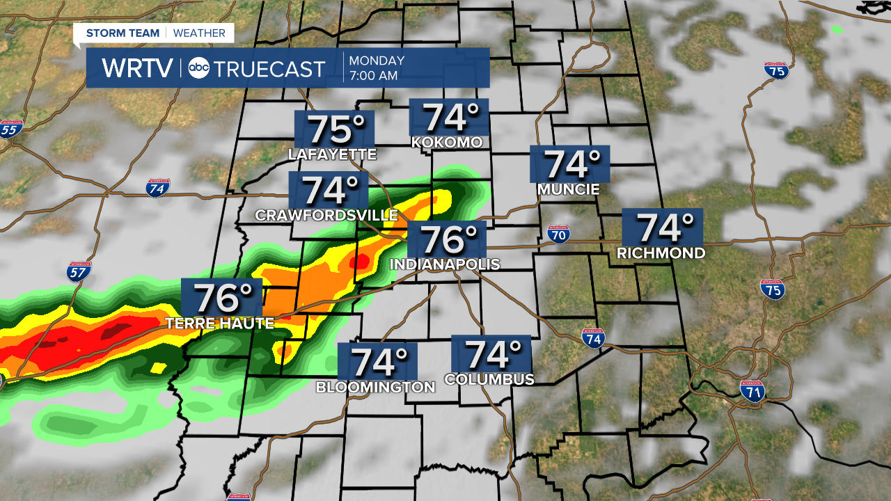
We will be watching for another complex of thunderstorms to develop Sunday night. This time, we we will be watching the area over eastern Iowa and southern Wisconsin.
Several high-resolution computer models suggest the thunderstorms will dive southeast, arriving in central Indiana after midnight Sunday. Thunderstorms should be decaying/weakening as they enter Indiana. We could hold on to some of the showers and thunderstorms through sunrise Monday. This is depicted in the image below.
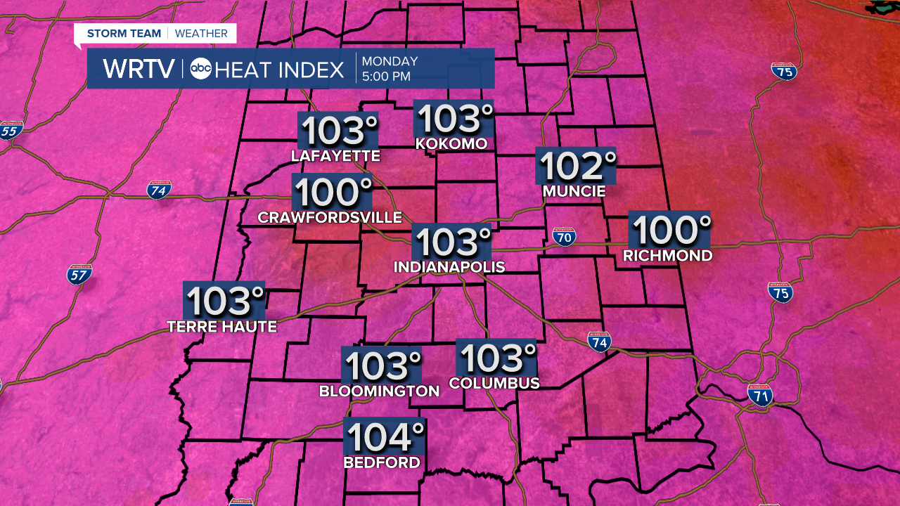
After the storms pass, clouds will erode and skies will become mostly sunny. This will allow temperatures to quickly warm through the morning and afternoon. Highs should be in the lower to near middle 90°s.

Plenty of low-level moisture will be in place. Dew point temperatures - the measure of the moisture in the air - will be in the lower to middle 70°s throughout central Indiana making it feel very uncomfortable. Peak heat indices will be from 100° to 104°.
While organized thunderstorm development will hold off Monday afternoon, I can't rule out the chance of a few isolated showers and thunderstorms in the heating of the day.
Another complex of thunderstorms is projected to develop late Monday night, passing through central Indiana early Tuesday morning. We'll have more updates on location and timing as we go through Monday.
Heat and humidity will remain in place until a cold front passes. Medium-range computer models suggest that happens Wednesday. Behind the front, cooler/drier air will move in to the Hoosier state providing for very comfortable conditions late in the week.
Indianapolis Weather Forecast:
Monday: Mostly sunny, warm, and humid. High: 94° Peak heat index: 103°
Tuesday: Partly cloudy, warm, and very humid. PM t'storms. High: 92° Peak heat index: 102°
Wednesday: Mostly cloudy. Showers and thunderstorms south. High: 81°
Thursday: Sunny and comfortable. High: 78°
Indianapolis 7-Day Weather Forecast

