


Get the fall layers ready! This week brings our coolest temperatures since late April.
Quite a few clouds are expected Monday. Northern areas could even see an isolated shower. Our NW breeze stays persistent with gusts between 20 and 25 mph. That keeps highs in the upper 50s. A big change from recent days.

wrtv
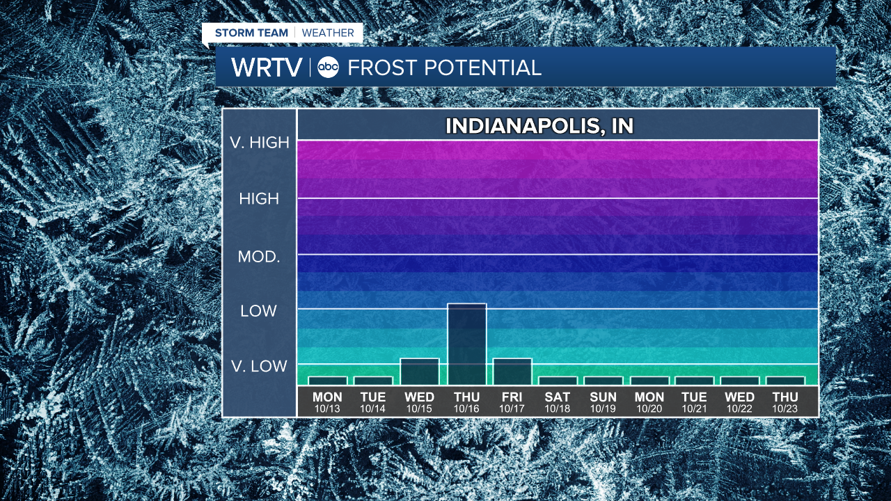
Cool afternoons lead to some chilly nights. Areas of frost are possible Wednesday and Thursday mornings. That's when low temperatures are expected to dip into the lower and middle 30s.
wrtv
Indianapolis Weather Forecast:
Monday: Partly sunny to mostly cloudy. Isolated shower. High: 59°
Tuesday: Decreasing clouds. High: 55°
Wednesday: Mostly sunny. High: 57°
Thursday: Mostly sunny. High: 62°
Indianapolis 7-Day Weather Forecast

wrtv
