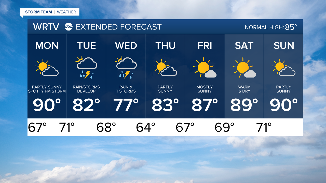
Skies become partly sunny Monday. The amount of cloud cover will impact our afternoon highs. We're looking at highs around 90 degrees, but more clouds would hold those temperatures back a couple of degrees. A spotty PM storm can't be ruled out late Monday into Monday night.

After making landfall in Texas, the remnants of Beryl are expected to slide our direction. There are still some questions in the exact track of the system as it gets pulled into the main flow of weather across the U.S.

While the path will impact the axis of heaviest rainfall, we're getting a better idea of the timing. Rain and a few storms are likely to develop during the day Tuesday with heaviest rain Tuesday night into Wednesday. Severe weather isn't expected. Models are coming in with more than 1" of rainfall. Some areas seeing more than 2" of rain isn't out of the question.

Indianapolis Weather Forecast:
Monday: Partly sunny. Spotty storm possible late. High: 90°
Tuesday: Mostly cloudy. Rain and storms develop. High: 82°
Wednesday: Mostly cloudy. Rain and storms. High: 77°
Thursday: Partly sunny. High: 83°
Indianapolis 7-Day Weather Forecast