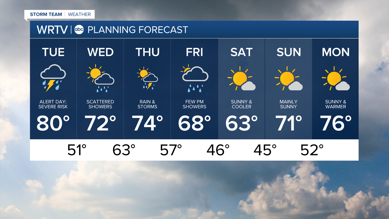
Headlines
- SEVERE WEATHER RISK TUESDAY
- RAINY END TO WEEK
- DRY BUT COOLER WEEKEND
Stay weather aware Tuesday, as we could continue to see a strong or severe storm. Outside of storms, we will see wind gusts up to 35 mph today with temperatures in the 70s.

Storms could bring periods of heavy rain, gusty winds, and large hail. An isolated tornado cannot be ruled out, but this threat looks less likely today. The evening commute could be slow going with wet and windy conditions. Some ponding is possible in low-lying areas, but widespread flooding is not likely.

We dry out late this evening and overnight. More scattered rain showers are expected on Wednesday.

The active weather continues with more rain and storms Thursday, then a few showers Friday afternoon. We will dry out and cool down this weekend.
Indianapolis Weather Forecast:
Today: Alert Day. Scattered storms that could be strong or severe. High: 80°
Overnight: Some clearing. Low: 51°
Wednesday: Increasing clouds. Scattered showers. High: 72°
Indianapolis 7-Day Weather Forecast