


Headlines
- VERY COLD TEMPS ALL WEEK
- ACCUMULATING SNOW POTENTIAL TUESDAY NIGHT
- TEMPS CLIMB THIS WEEKEND
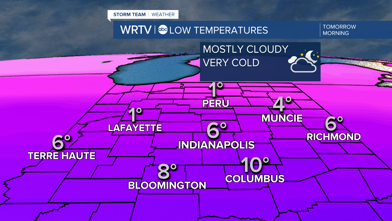
Despite cloudy skies, temperatures still plunge into the single digits by Tuesday morning. A few spots over the northern half of the state may drop below zero. Wind chill values will drop to around 5 below zero.
With mostly cloudy skies and a cold north wind, high temperatures will remain almost 25 degrees below average Tuesday afternoon.

Tuesday night a storm will pass just to our south. Once again close enough for some accumulating snow. A fluffy snowfall may make conditions slick Wednesday morning. The heaviest snowfall, 4" to 6", is likely along and south of the Ohio River.

The storm track will determine final snow totals, but farther north into Central Indiana snowfall amounts will decrease.

Light accumulating snow is possible again Wednesday night into Thursday morning
Warmer temperatures arrive for the weekend!
Indianapolis Weather Forecast:
Overnight: Mostly cloudy and cold. Low: 6°
Tuesday: Mostly cloudy. Snow late to the south. High: 18°
Wednesday: Light snow early. High: 21°
Indianapolis 7-Day Weather Forecast

