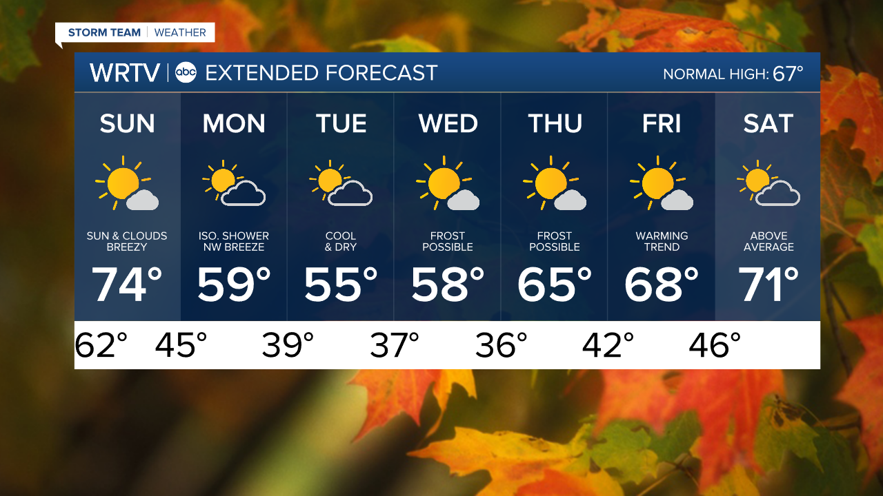
Our weather pattern begins to change Sunday. West winds turn NW with a passing cold front. Gusts between 20 and 30 mph limit afternoon highs to the lower and middle 70s with a mix of sun and clouds.

We make the transition to unseasonably cool air to start the week. High temperatures will be limited to the mid to upper 50s Monday through Wednesday. An isolated shower is possible across northern areas Monday. Otherwise, our dry stretch is expected to continue. The week also brings our first potential for frost. Wednesday and Thursday mornings have the best chance of frosty starts with lows in the middle 30s.

Indianapolis Weather Forecast:
Sunday: Sun and clouds. Breezy. High: 74°
Monday: Partly sunny. Isolated shower north. High: 59°
Tuesday: Sun and clouds. High: 55°
Wednesday: Mostly sunny. High: 58°
Indianapolis 7-Day Weather Forecast