


Before the threat for storms, we get to enjoy our warmest day yet. Temperatures climb into the upper 70s and lower 80s. Indy's record high of 81° was set in 2012. We'll have partly sunny skies as winds increase through the day.

Wind gusts around 30 mph will be possible this afternoon. A Wind Advisory is in effect for much of Central Indiana from 7 PM Friday to 4 PM Saturday. Gusts between 40 and 50 mph are expected Friday night into Saturday. Higher gusts are certainly possible as storms move through the area.
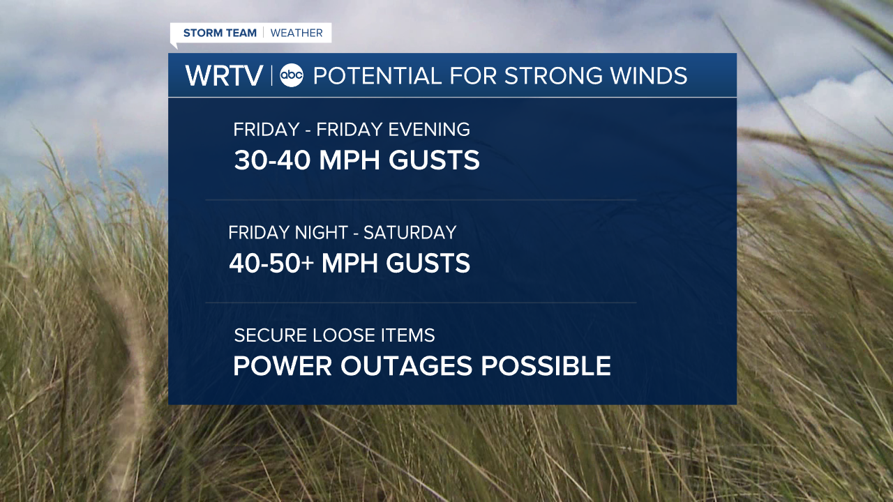
Our severe weather potential arrives after midnight and lasts into the early morning hours of Saturday. Much of the eastern half of Central Indiana is in a Slight Risk (Level 2 of 5) for severe weather. Areas west of Indianapolis are in an Enhanced Risk (Level 3 of 5). Damaging winds are the primary severe weather threat, but tornadoes can't be ruled out. Be sure to secure loose outdoor items. Power outages are also possible. Given the timing, it's extra important to have a way to be alerted to severe weather threats while you're sleeping. Stay tuned to the WRTV Storm Team for updates.

Indianapolis Weather Forecast:
Friday: Partly sunny. Warm and breezy. High: 79°
Friday Night: T'storms develop. Low: 60°
Saturday: Scattered t'storms and windy. High: 73°
Sunday: Showers possible early. High: 49°
Indianapolis 7-Day Weather Forecast

