

A fantastic end to the weekend. Mainly clear skies, lower temperatures, and the humidity has taken a dive. Temperatures topped out in the 70°s to near 80° throughout central Indiana. Indianapolis topped out at 76°, meaning Sunday felt more like September 26 than June 30.
Clear skies tonight will send temperatures dropping in to the upper 40°s (outlying areas) to middle 50°s Monday morning. A great night to open your windows and turn off the air conditioning.

Monday will start with lots of sunshine. As we get in to late afternoon you'll notice high altitude clouds arriving. Temperatures will be just a degree or two warmer than Sunday. High will be in the 70°s.

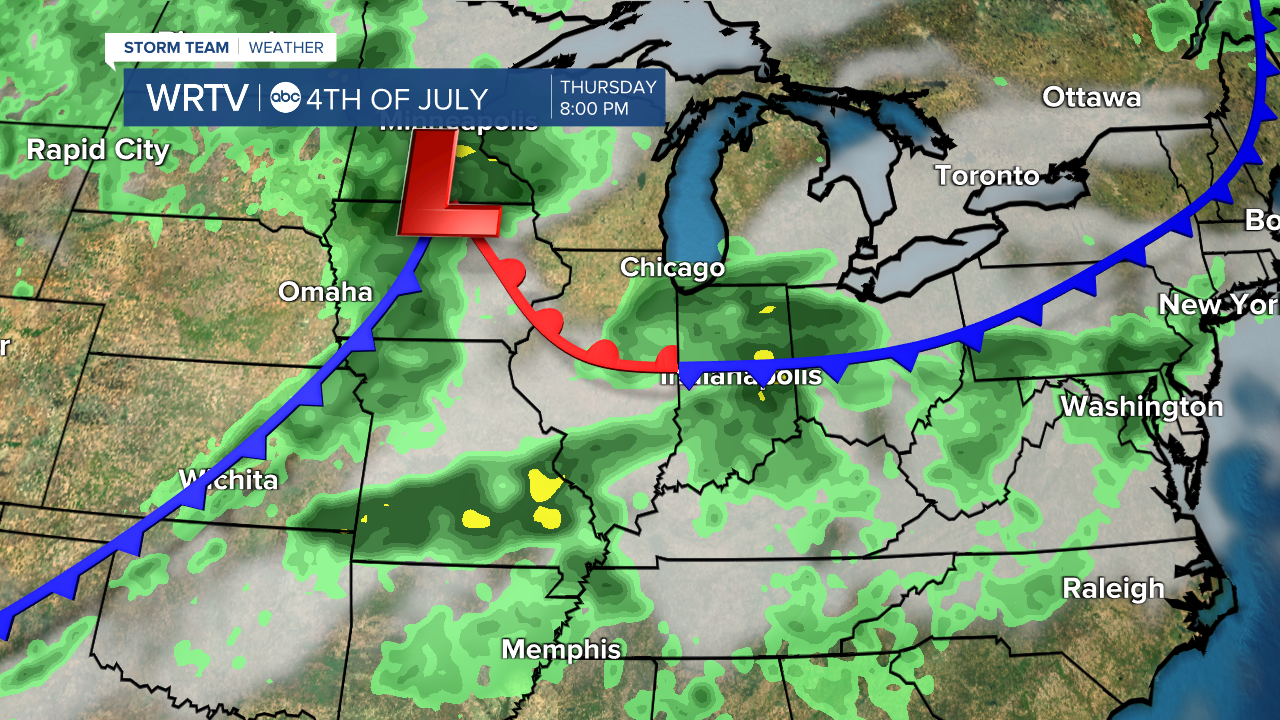
We move back to a summer pattern starting midweek. Temperatures will climb to near 90° Tuesday. It should get in to the low 90°s Wednesday ahead of a cold front. Medium range computer models suggest the front will drape over the Ohio River Valley for the upcoming holiday. This will produce a daily chance for showers and thunderstorms Wednesday, Thursday, and Friday.
Indianapolis Weather Forecast:
Monday: Mostly sunny. High clouds arrive by late afternoon. High: 77°
Tuesday: Increasing clouds and warmer. High: 89°
Wednesday: Partly cloudy, warm, and very humid. Scattered PM t'storms. High: 92°
4th of July: Scattered showers and thunderstorms. Very humid. High: 84°
Indianapolis 7-Day Weather Forecast

